Thanks for visiting!
This blog is where I share stories behind the images, thoughts on the creative process, and insights into the gear and techniques I use.
Whether you're here for inspiration, curiosity, or connection, I hope you find something that resonates. Feel free to explore, comment, and come along for the journey.
HP Designjet Z3100 24" Printer

Bought myself a HP Designjet Z3100 24" printer. Looking forward to many years of large format printing!
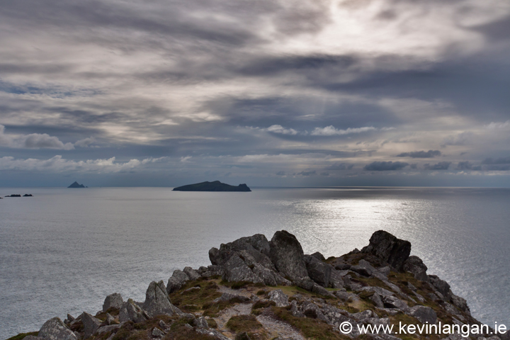
Reflective mood on the Dingle Peninsula
|
| Clogher Head |
It’s hard to escape history in a place like this, especially when the Dingle Peninsula has supported various tribes and populations for almost 6,000 years. Evidence of that past is strewn all over the landscape, visual reminders of a rich a varied past , one steeped in history, folklore and one that is everpresent on my mind.

|
| The Blasket Islands |
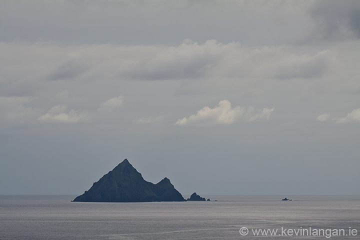
I have never been on the island, or any of the other Blasket Islands for the matter, but looking at it now over the Blasket Sound it’s hard to imagine anyone wanting to live there. The only inhabitable area of the ‘Great Blasket Island’ is at the east side, protected, some what form the elements by a steep incline that dominates the rest of the island. On record, the population of the island at it’s peak in 1916 was 176 people. How they all managed to fit on such a tiny piece of land, let alone sustain themselves baffles me. One can only imagine the hardship those people must have gone through, with a constant struggle for survival. Following the First World War, the island began to decline and in 1953 the last twenty inhabitants left the island.
|
| Inishtearagh |
Being in such a rich environment, with such a rich history and natural beauty is all consuming. The many time I have visited the peninsula I always come away better for the experience. From a photographers perspective, places like the Dingle Peninsula offer so much. Jutting out as it does into the sea, the most westerly point in Europe, the peninsula has a rugged and beautiful coastline. Battered by the Atlantic ocean and the predominant westerly winds, the coastline is visually stunning, particularly along it’s most westerly points.

|
| Headland View |
Evenings like the one I experienced on Clogher Head, on a stunning summers evening offer so much. Consumed by history and natural beauty I left with heavy heart, but happy in the knowledge that I would return soon and maybe next time I will be pointing my camera towards the mainland, wondering why anyone would want to live there!
For more photo's of the Dingle Peninsula go to:
www.kevinlangan.ie
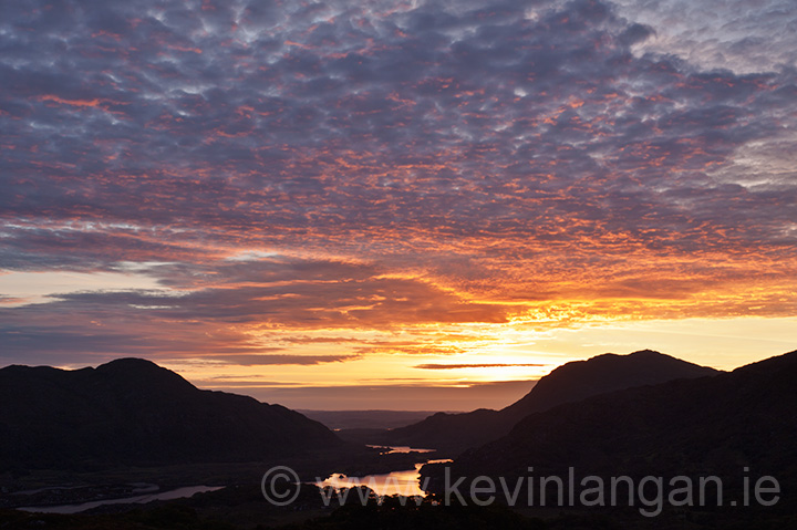
Dawn Shoot, Killarney, Co. Kerry
|
| Ladies View |

|
| Eagles Nest |
|
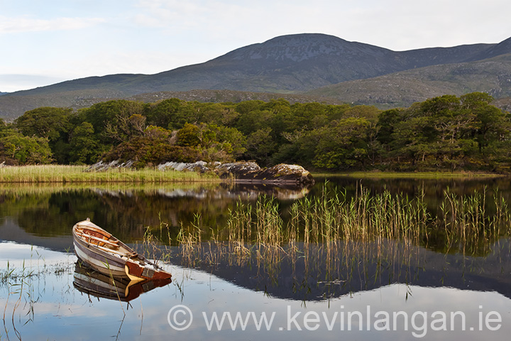
| Upper Lake Killarney |
Black & Brida Valleys, Killarney, Co. Kerry
07/04/2010
Following my recent visit to the McGuillicuddy Reeks, I promised myself to return soon to explore the Black and Brida valleys running between the mountain range. The view from the top of the Devils Ladder a few weeks earlier had given me some insight into the splendor of the valley, but being at ground level is the best way to experience the magnitude of the mountain range. Having previously experimented with panoramic stitching in Photoshop, I knew the best way to capture the valley was to combine several shots into one; my mission on the day was to do just that. Having discussed my plans the day before with my brother, he decided he would tag along for the trek. In all the years we have been coming to Killarney, neither of us had explored this area, so we were looking forward to what it had to offer.

|
| My brother Alan enjoying the view! |
We approached the Black valley from Moll’s Gap South of Killarney on the Kenmare road. Once at the gap, we turned left and took the first right down into the valley. The road is windy and narrow, but you soon find yourself immersed in the beauty of the natural habitat with the Owenreagh river running along the right hand side of the road. The road into the valley intersects with the “Kerry Way” walk, a walk that starts just outside Killarney town near the river Flesk and runs all around the Iveragh peninsula. We decided to drive as far as we could following the “Kerry Way” route until we turned off to the Cummeenduff lake. Passing the lake, we parked in a lay-by as far as we dared go and proceeded to get kitted out. We set off on foot along a narrow road until we intersected the “Kerry Way” walk again. The road led to a farm, the most isolate farm I have ever come across. Both of us pondered on what it would be like to live in such an isolated part of Ireland, getting to the shops must be a real hassle we mused.

|
|
The Brida Valley |
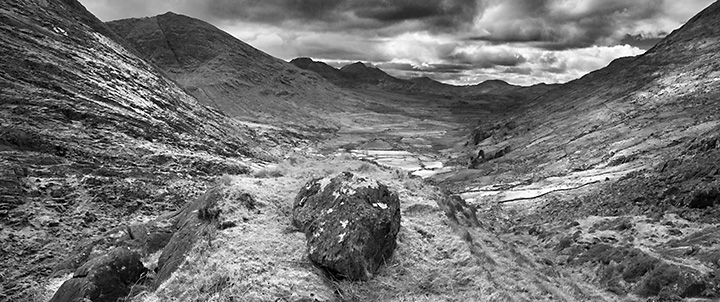
Walking around the side of the farm, we continued on until a decision had to be made whether to stick to the “Kerry Way” route or head upwards towards the base of Carrauntoohil. We decided on the latter. I knew from my climb a few weeks previous that there was a lake at the base of mountain and I was anxious to explore it. The lake in question is Curraghmore, the source of the Cummeenduff river that flows into the Cummeenduff lake that feeds the Gearhameen river and untimately flows into the Lough Leane. Having survived the steep incline to the lake, we took a breather and had some lunch. After several ham sandwiches and a nice warm cup of tea, I decided to get the camera warm up with a few shots of the lake with the mountains in the background. Not feeling too happy with what I had captured, I followed my brother over a hill to get a good view of the valley from up high.

|
| Brida Valley Pan |
|
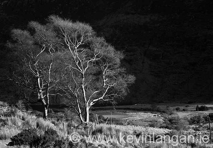
| Looking Westwards |
|
| The Black Valley |
Carrauntoohil
Carrauntoohil
Carrauntoohil had been on my mind for several months before I finally got the impetus to photograph the highest mountain range in Ireland.
On a cool Saturday morning my buddy Fionn and I headed off from North Kerry with the intention of taking some photographs around the base of the mountain. I knew in the back of my mind that plan would alter once we got there. Both of us are the adventurous type, so spending the day at the base of a mountain was never going to happen.
Fionn run’s his own aerial photography business www.aerialphoto.ie and takes panoramic images using an SLR mounted onto an electronically rotatable housing that is fixed to a remote model helicopter.
We arrived in Cronin’s yard at 10:30am and got kitted out. The day was overcast but dry, not ideal for photography but we were glad it wasn’t raining. There were a few cars already in the yard when we arrived and as we headed off we encountered two climbers on the way back, obviously early starters.
The trail into Hag’s Glen runs adjacent to the Gaddagh River and is a gentle stroll for about 3km. As we traversed up the glen we decided to stop at the Callee Lake for a breather, have something to eat and to take the first photos of the day.
After spending some time looking through the viewfinder from several angles I decided on a view from the edge of the lake with the mountain in the background. I set up my tripod and focused on a large boulder in the foreground and set the aperture to f/22 for maximum sharpness. I adjusted my polarizer to maximize the contrast and to eradicate the reflected light on the lake and took a few exposures in the hope of combining them later in Photoshop. Like all my photographs I shoot in colour and have the option to convert to black & white later in Photoshop. I also used a contrast mask to bring up the midtones.

|
| Lough Callee |
It was the first time I saw Fionn’s model helicopter in action. It’s a serious bit of kit. He has a 450D attached to the housing, angled at around 30° to the ground. He uses a fast 8mm fish-eye-lens to get a wide-angle of view and to shoot a fast shutter speeds. The housing rotates 360° to capture al full panoramic. The results are fab.
After spending a good half hour at the lake we decided to climb the infamous ‘Devils Ladder’ to get a view from the top. It is an arduous climb full of loose rocks and shale. Once at the top the views made it all worthwhile. At an altitude of around 700m the views were spectacular.
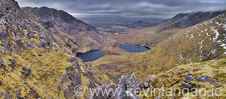
We rested up for another while before taking any more photographs. I had my sights set on the view looking north over Hag’s Glen and decided that a panoramic photo was required to capture the scene successfully. The views on the other side of the mountain range were equally spectacular, you could see as far West as the Atlantic.
|
| View from the Devil's Ladder |
Fionn launched his helicopter again and took it up around 30m to capture a 360° from that perspective. The panoramic sticking really gives you a sense of the place especially from a birds-eye view.
 
|
| 360 Pan |
After spending over an hour at the top of the ladder we decided that a second trip was necessary on a clearer day to tackle the summit. The climb down wasn't as bad as I expected, we were down in no time to see the sky open up for a beautiful evening.